
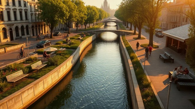
Origins of the Paillon and Why the City Covered It
The Paillon River rises at roughly 1,300 meters and runs 35 kilometers to the Mediterranean through Nice. City planners and engineers covered sections of the river from 1867 through the 1970s to manage sudden floods, reclaim land for urban expansion, and address sanitary and circulation needs. Concrete conduits replaced open channels, converting a working river that once powered mills and formed part of Nice’s western defenses into a buried watercourse beneath streets, parking and buildings.
How and When the River Was Enclosed
Engineers first enclosed the Paillon around Place Masséna between 1867 and 1869. They progressively extended reinforced concrete covers over the natural bed in subsections, matching the city’s growth. phases By mid-20th century the rise in automobile traffic accelerated works: from 1956 the covered sections were repurposed for transport infrastructure such as a bus terminus and multi-storey parking. In cumulative phases roughly 2.3 kilometers of river became subsurface, creating a continuous platform for urban functions.
Technical Approach Used to Cover the River
Technicians used staged construction to keep water flow and avoid upstream flooding: first they diverted or channelled the flow, then built reinforced concrete vaults spanning the old channel. Key steps included: 1) surveying and mapping the existing bed and sewer network; 2) building temporary cofferdams and diversion channels; 3) installing foundations and reinforced concrete arches or slabs; 4) backfilling and layering road or plaza surfaces over the vaults; 5) connecting stormwater and sewage systems to the new covered conduit. This sequence allowed the city to add transport and parking capacity without halting river discharge or raising flood risk elsewhere.
From Concrete Platforms to Public Park: The Promenade du Paillon Project
In 2013 Nice opened Promenade du Paillon by removing obsolete transport structures and substituting them with green and water features that sit above the buried river. Urban designers replaced asphalt and parking decks with 12 hectares of continuous parkland containing pedestrian paths, reflective water basins, misting systems, children’s play areas and broad lawns. The project reused the structural cover as a load-bearing deck while adding a lightweight horticultural substrate, drainage layers and irrigation to support mature plantings without compromising the vaults below.
Design Details That Make the Park Work
The park’s success rests on several measurable design decisions. Planners left the subsurface structure accessible for inspection and maintenance, integrated permeable surfaces to limit runoff into the vault, and placed large planters to concentrate root systems where vault strength allowed. Water management uses reclaimed and treated city water for misting and ponds, reducing potable demand. The linear park reconnects key urban nodes — Place Masséna, the old town and the seafront — creating continuous pedestrian flow and redistributing foot traffic away from narrow streets.
Social, Environmental and Economic Effects
Promenade du Paillon generates multiple benefits: it increased urban green-space per inhabitant, lowered local surface temperatures through evapotranspiration and shade, and improved stormwater attenuation by adding permeable areas. Economically, the park boosted surrounding commercial activity by increasing dwell time and improving property values along its edges. Socially, it created inclusive public space used for markets, informal gatherings and programmed events, transforming a transport footprint into a civic amenity.
How the City Plans to Expand to 20 Hectares
Nice officials plan to expand the Promenade by roughly 8 hectares to reach a total of 20 hectares, extending green cover into adjacent blocks. Expansion steps include structural surveys of additional vaulted sections, phased removal of remaining above-ground transport structures, soil and substrate engineering to adapt to vault load limits, and community consultations to define programming and access. The expansion will prioritize tree canopy continuity, improved cross-street connections and integrated stormwater harvesting.
Lessons for Other Cities Considering River Burial Reversal
Nice’s experience shows key considerations for cities that want to repurpose covered rivers: perform comprehensive structural assessments of existing vaults; design lightweight but deep-enough planting systems to support mature trees; maintain access to the buried conduit for inspections and repairs; and pair greening with water reuse systems to limit additional loads on municipal supply. A phased approach — remove obsolete infrastructure first, test soil and vault response, then plant — minimizes risk and cost while delivering measurable environmental and social gains.
Examples and Data to Inform Replication
Practical metrics from Nice: the conversion reclaimed ~12 hectares in the initial phase, reduced asphalted surface area slightly, and integrated misting and reflective pools that lower adjacent daytime temperatures by measurable margins (local microclimate monitoring showed notable cooling near water features). Comparable projects that inform best practice include urban daylighting initiatives and vaulted-river park conversions in other European cities where structural re-use, phased planting and community programming formed core success factors.
Quick Implementation Checklist for Municipal Teams
1) Map and record the buried channel and connected infrastructure.
2) Conduct structural integrity and load-bearing assessments of vaults.
3) Design a lightweight soil profile and place tree pits where vaults permit heavier loads.
4) Plan phased removal of obsolete surface infrastructure with temporary diversions if needed.
5) Integrate water harvesting, recycled water for features and permeable paving.
6) Schedule long-term maintenance and vault inspection access.
7) Engage communities early about programming, access and safety.
What Residents Can Expect from the Expanded Park
Residents will gain more shaded pedestrian routes, larger contiguous lawns, improved ecological connectivity and expanded event spaces. The extension will reduce localized heat islands, increase biodiversity corridors through additional plantings and provide safer, car-free routes that knit neighborhoods to the seafront.
Conclusion
Nice transformed a once-concealed river corridor into a multifunctional urban park by combining structural engineering, adaptive reuse and landscape design. The Promenade du Paillon demonstrates how buried waterways can become assets again when cities prioritize green infrastructure, phased technical interventions and community use.





Be the first to comment