
UHUM: National Space Weather Monitoring and Modeling Center
The National Space Weather Monitoring and Modeling Center (UHUM) will collect, process, and distribute space weather data to protect satellites, communications, navigation, and critical infrastructure. UHUM will deploy a distributed network of ground sensors, integrate satellite-borne telemetry, and operate real-time modeling engines that translate particle fluxes, geomagnetic disturbances, and ionospheric fluctuations into actionable alerts. The center will enforce open-data policies and adopt international exchange formats so domestic researchers and foreign partners can access the same validated data streams.
How UHUM Delivers Immediate Operational Benefits
UHUM provides timely, operational products that stakeholders can apply directly:
Satellite life and operations: When proton and heavy-ion fluxes rise, UHUM alerts will recommend switching payloads to safe modes, adjusting charging Mitigation, or delaying maneuvers—measures that demonstrably extend component lifetime and reduce mission risk.
Communications and GNSS integrity: UHUM’s ionospheric models will supply correction parameters and confidence intervals to GNSS service operators and aviation navigation managers, lowering position errors during scintillation events.
Power grid and critical infrastructure protection: UHUM will issue geomagnetically induced current (GIC) forecasts and localized risk indices allowing grid operators to implement phased load adjustments, transformer load shedding, or temporary operational constraints to avoid permanent hardware damage.
Three-Phase UHUM Implementation Plan
UHUM will progress through three concrete phases with deliverables tied to months and measurable outputs:
Phase 1 — Sensor and Ground Network Deployment (Months 1–9): procure magnetometers, riometers, ionosondes, and compact cosmic-ray monitors; site and install instruments at at least five geographically distributed stations; Establish secure links to a central data hub. Deliverable: calibrated data streams with provenance metadata.
Phase 2 — Modeling and Data Processing (Months 6–15): develop assimilative ionosphere and magnetosphere models, implement machine-learning anomaly detectors, and create real-time dashboards and API endpoints. Deliverable: validated forecast products (eg, 24–48 hour geomagnetic and forecast radiations) with documented skill scores.
Phase 3 — Education, Standards, and International Integration (Months 12–24): run joint training programs with universities and industry; formalized data-sharing agreements with ESA, EISCAT-class networks, and regional partners; adopt established interchange formats. Deliverable: certified training cohorts, signed MOUs, and routine data exchange pipelines.
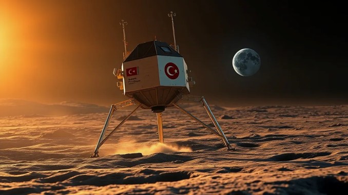
AYAP-1: Moon Mission Schedule and Key Technical Milestones for 2027 Launch
AYAP-1 will complete system verification, payload integration, and environmental testing ahead of a 2027 launch window. The program focuses on robust subsystem testing and clear acceptance criteria to avoid last-minute slips.
System verification: perform end-to-end communications and telemetry checks in hardware-in-the-loop racks; run thermal vacuum sequences replicating lunar sunrise/sunset cycling; Validate power budgets against worst-case eclipse and degradation scenarios.
Payload integration: install cameras, spectrometers, and surface interaction sensors with electromagnetic compatibility (EMC) checks; Execute data-flow verification from sensor to mass-memory to telemetry downlink.
Launch campaign: complete assembly and integration with launcher adaptor, execute vibration and shock acceptance tests, and finalize ground segment readiness including contingency procedures and launch-vehicle interface tests.
Technology Maturation and TRL Advancement from AYAP-1
AYAP-1 will raise critical components’ Technology Readiness Levels (TRLs) through flight-like environmental exposure and operational validation. Examples include: advancing radiation-hardened electronics from TRL 5 to TRL 7 after integrated thermal/vacuum and radiation testing; validating autonomy software via demonstration missions and increasing its readiness for long-duration, low-latency operations.
İMECE Satellite Series: What Completes Next Year
İMECE-2 will finish integration and environmental testing and proceed to launch readiness; İMECE-3 will move into full system-integration. Key activities include:
Integrated test sequence: execute vibration, acoustic, thermal vacuum, and EMC tests; confirm structural margins and harness routing under flight load cases. Deliverable: acceptance flight certificates.
Ground station and propulsion readiness: expand ground-station scheduling software, upgrade S-band/X-band telemetry handling, and commission electric propulsion test rigs to confirm delta-v and orbit maintenance profiles. Deliverable: continuous command/telemetry cycles at mission representative data rates.
Three-Layer Collaboration Model to Scale National Capabilities
Build a collaboration model that aligns incentives and responsibilities across sectors:
Academia–Industry partnership: universities supply specialized research and graduates; industry provides production, assembly, and supply-chain scaling. Structure joint programs with funded problem statements, graduate co-op placements, and IP-sharing terms tied to commercialization clauses.
Institutional coordination: national agencies (Turkey Space Agency, TÜBİTAK) will define standards, maintain project-level governance, and negotiate international agreements. Use modular project management templates to harmonize timelines and acceptance criteria.
International partnerships: sign bilateral data-exchange and cooperative mission MOUs with European and Asian agencies to secure rideshare opportunities, cross-calibration datasets, and cooperative science operations.
12-Month Action Calendar with Deliverables
Concrete month-by-month actions help avoid scope creep and provide internal checkpoints:
Months 1–3: finalize sensor and ground-station technical requirements; issue procurement packages; produce technical specifications and a prioritized vendor list.
Months 4–6: install prototype sensor nodes; deploy initial data-collection software; start iterative model training on historic and synthetic event datasets; deliver beta platform and test dataset.
Months 7–9: scale sensor network, begin continuous operations, run end-to-end data ingestion and processing workflows; Deliver the first operational monitoring product and dashboard.
Months 10–12: run national training workshops, finalize international data-sharing agreements, and publish SOPs for operators; deliver trained personnel and signed cooperation agreements.
Risks and Practical Mitigations
Major program risks include supply-chain interruptions, schedule slippage, and interoperability gaps. Apply these mitigations:
Flexible procurement: prequalify multiple vendors for critical parts and maintain a rotating buffer stock for long-lead items.
Incremental integration: adopt modular builds and continuous integration tests to surface interface issues early and reduce late rework.
Contractual and cybersecurity safeguards: prepare standardized legal frameworks for international data sharing and implement tiered cybersecurity controls for telemetry and archival systems.
Expected Outcomes and Long-Term Impact
Completion of UHUM, AYAP-1, and the İMECE series will deliver measurable national capabilities: increased satellite operational lifetimes, reduced outage rates for navigation and communication services during space-weather events, improved resilience of power grids, and a deeper national talent pool in space systems engineering. Over five years, these programs can lift domestic TRLs, produce exportable technologies, and position Turkey as a regional hub for applied space-weather services and small-satellite platforms.









Be the first to comment