
What is Grüner See and where is it located
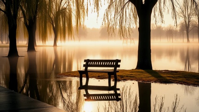
Grüner See sits in the Tragöss municipality at the base of the Hochschwab Mountains in Styria, Austria. In autumn and winter it resembles a small, grassy park with walking paths, wooden benches, bridges, and a shallow pond of 1–2 meters. Each spring melt transforms the valley into a deep, crystal-clear lake that can reach up to 12 meters in depth.
How spring melt creates a 12-meter deep lake
Snowpack on the Hochschwab massif melts rapidly between late April and June. Cold meltwater drains down steep karst channels and accumulates in the closed valley basin where the park sits. Because the basin has limited surface outlet capacity, water level rises quickly. Measured seasonal rise typically reaches around 10–12 meters above the winter pond level; local hydrological data and repeated observations confirm this annual pattern.
Timeline: when the lake fills and when it recedes
The filling and draining cycle follows a predictable timeline tied to temperature and snowpack:
April–May: Temperatures rise, initial melt begins, water level climbs noticeably within weeks.
May–June: Peak inflow from snowmelt; lake reaches maximum depth (commonly around 10–12 meters).
July: Summer temperature reduces inflow; outflow and evaporation lower the lake level, exposing submerged park features.
August–Winter: Water retreats to form the shallow pond and grassy park again, and the cycle repeats the next year.
Why the water is exceptionally clear
Karst geology and cold meltwater together keep the lake interesting transparent. Meltwater travels through limestone and dolomite with limited suspended sediment; low suppress temperatures algal bloom during the filling season; and limited inflow of organic-rich surface runoff preserves clarity. Divers and underwater photographers report visibility often exceeding 10 meters during peak water.
Which park features become submerged and what they look like underwater
Benches, wooden bridges, walking trails and trees that are fully accessible in winter become part of an underwater scene in May–June. From a diver’s perspective you can swim along park paths, pass under the same small footbridges, and view benches and signposts coated in fresh, clear water—an unusual mix of terrestrial structures set in an aquatic environment.
Safety, access, and visitor guidance
Approach Grüner See with seasonal awareness. In high water months the park transforms into a diving and snorkeling site rather than a typical picnic area. Local authorities regulate access at times to protect both visitors and the fragile environment. Recommended precautions:
Check local notices for closure or permitted activities;
Use appropriate equipment—if entering the water, wear drysuit or thick wetsuit because meltwater is near freezing;
Hire certified guides for diving; karst features can create unexpected currents and sinks;
Respect signage and avoid entering protected zones that sustain rare flora.
Practical tips for photographing and diving Grüner See
For photographers: work in the window when the lake is at peak clarity (late May to early June), carry wide-angle lenses to capture submerged banks and trees, and use buoyancy control to avoid stirring sediments. For divers: book through local dive operators who know seasonal hazards, plan shallow-line routes along submerged trails, and limit dives to conditions of good visibility and mild weather. Both photographers and divers should carry waterproof cameras with neutral buoyancy setups to reduce disturbance.
Examples and data from past seasons
Recent seasonal records show repeatable maximum depths near 10–12 meters during warm snowmelt years and slightly lower maxima following light-snow winters. Visitor reports and water-level logs maintained by regional environmental agencies provide specific dates for rise and fall each year, useful for planning a trip in the peak window.
How climate variability affects the lake
Interannual variation in snowfall and spring temperatures changes the timing and maximum depth. A heavy snow winter can extend the high-water window later into June and raise the peak depth; Conversely, low-snow winters and early warm spells can shorten the high-water phase. Long-term shifts in mountain snowpack will alter future frequency and extent of the 12-meter phenomenon.
Quick checklist for a seasonal visit
Before you travel, confirm these items:
Dates—plan for late May to early June for maximum water levels;
Gear—warm wetsuit or drysuit, mask/snorkel or dive kit;
Local rules—check municipal guidance on access and permitted activities;
Guides—book a certified guide if diving;
Respect—stay on permitted paths when the park is dry and avoid disturbing submerged features when it is full.






Be the first to comment