
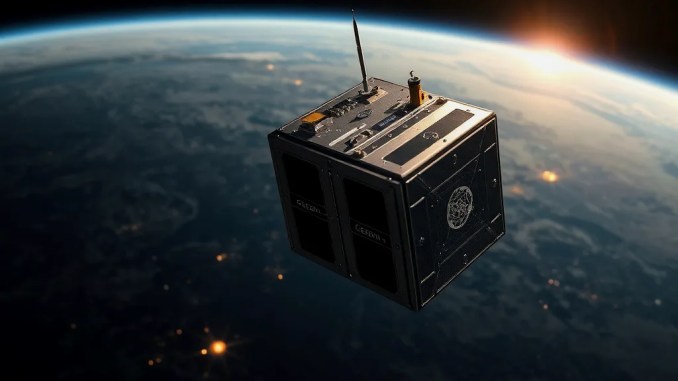
GEZGİN-1 Project Goal and Timeline
Turkey develops a high-performance platform in the micro-satellite class weighing under 75 kilograms. Project phases include design, ground tests, integration, and launch preparations. The pre-series production flight model is planned to be launched in the last quarter of 2028, and the timeline may be updated depending on component procurement, testing of domestic subsystems, and fulfillment of integration criteria. This plan identifies critical roadmaps (critical component procurement times, test delays) and defines measurable deliverables (design reviews, hot-cold thermal tests, EMI/EMC reports) for each phase.
Technical Specifications and Platform Architecture
GEZGİN-1 uses a lightweight composite and aluminum alloy body; the structural design incorporates optimizations to minimize vibration and thermal stress. The power system consists of high-efficiency solar panels and a Li-ion battery array; it offers power management, load prioritization, and charge-discharge cycle optimization. Thermal control combines passive solutions (isolation, radiators) with local active elements (ISI and small heathers). Communication links transmit high-bandwidth data over X and S bands; software-based data compression and packet prioritization shorten transmission time to the ground station. The steering and control system provides three-axis stability with mini reaction wheels, magnetorquers, and precision star sensors; attitude accuracy can be adjusted to a few arc-seconds depending on the mission.
Imaging capabilities: multispectral and high resolution
The satellite provides multi-band (multispectral) imaging: visible (RGB), near-infrared (NIR), and short-wave infrared (SWIR). The sensor configuration is optimized for both plant health analysis and surface material discrimination. Pixel resolution is planned at the level of a few meters depending on the mission requirement; The image processing pipeline automates ground targeting, geometric correction (orthorectification), and atmospheric correction (Sen2Cor-like approaches). Ground-based spectrometer measurements and regular vicarious calibration campaigns are conducted for sensor calibration, ensuring time-series consistency and radiometric accuracy.
AI and data processing infrastructure
Images received at the ground station enter the AI pipelines after preprocessing (cloud masking, radiometric correction). Fields from Turkey, seasonal spectrometric sampling, and labeled datasets are used as training data. AI algorithms are optimized for cloud masking, NDVI/EVI calculation, object detection (e.g., ship, structure, road), and change detection. An applied example: ship detection pipeline includes steps such as object extraction from optical image, size estimation, and cross-validation with AIS data. Real-time or near real-time alerts generate automated reports for critical agricultural anomalies or marine surveillance events; These are transmitted to the customer via API and visualized on dashboards.
Areas of use: precision agriculture and plant health
GEZGİN-1 offers crop condition assessment, irrigation efficiency analysis, and early disease and pest detection. Example workflow: (1) Weekly multispectral images are collected; (2) NDVI maps for fields are generated with NIR and red band data; (3) Field-based stress zones are identified; (4) Point irrigation recommendations and targeted fertilization maps are created. This workflow increases efficiency while reducing water and fertilizer inputs. In practice, sub-parcel level analysis and drone-based verification cycles are integrated according to the heterogeneity of the field.
Areas of use: mapping, land use, and environmental monitoring
High-frequency imaging is suitable for monitoring land-use changes, urban sprawl, forest cover loss, and coastal erosion. Example scenario: multispectral images are taken at three-month intervals after a forest fire in an area; The rate of renewal is numerically reported using temporal analysis and indices. This data can be directly used for rehabilitation prioritization and carbon stock assessment.
Application areas: maritime surveillance and ship traffic monitoring
Satellite AIS data is integrated with optical images; thus, detection of AIS-enabled vessels, routing analyses, and anomaly detection are performed. The AI target detection pipeline classifies, sizes, and flags behavioral anomalies of targets in the image. In emergencies, the system automatically sends rapid alerts to search and rescue teams; the alert content includes position, possible target size, and probability score.
Data products, access model, and service scenarios
The data products produced are: raw image, corrected orthorectified image, index maps (NDVI, NDWI, etc.), change reports, and automatic detection alerts. Access models are diversified into subscription, project-based licensing, or public-private partnerships. Example: local agricultural cooperatives subscribe to index reports for their fields with a monthly subscription; Municipalities purchase short-term urban surveillance packages. RESTful API, SFTP, and direct data stream (push) options are offered for technical access.
Previous observation satellites and experiences gained in Türkiye
Experience gained from the BİLSAT and RASAT projects, led by TÜBİTAK UZAY, followed by the İMECE and GÖKTÜRK series, provides critical information in optical imaging, communication protocols, and operational ground station processes. Field data and operational practices from these projects provide direct input for GEZGİN-1’s sensor calibration, mission operations, and domestic supply chain.
Success criteria, risks, and risk mitigation strategies
Success criteria: targeted image quality, orbital stability, data transmission time, and operational availability. Key risks are supply chain delays, thermal and power management challenges on small platforms, and integrated software failures. Risk mitigation steps include identifying redundant supply sources, conducting comprehensive ground tests (thermal vacuum, vibration, EMI/EMC), designing a scalable software architecture, and performing simulation-based verification. Phased demonstrator flights reveal critical software-hardware integration issues early.
Collaborations, industrial impacts, and the local ecosystem
The project requires a multi-stakeholder structure with universities, local industry, and international technical partners. Domestic subsystem production creates added value in the supply chain; reuse of components developed during the development process in subsequent satellite projects reduces costs. It also opens new markets for SMEs in testing, calibration, and software, and fosters local expertise.
Example scenario: 90-day implementation flow for a farmer
1) Days 0–7: Field boundaries and target area are defined, and historical seasonal data is collected.
2) Days 8–30: Initial NDVI maps are created using weekly GEZGİN-1 images; Irrigation and fertilization recommendations are communicated.
3) Days 31–60: Early disease symptoms are detected and a local intervention plan is recommended; yield estimate is updated.
4) Days 61–90: Final pre-harvest assessment, yield estimate verification, and seed/planting recommendations for the next season are reported. This workflow integrates remote sensing, ground measurements, and drone-based verification where necessary.
Sustainability, data privacy, and regulation
Data management policy protects users’ location and product data; anonymization, role-based access, and end-to-end encryption are implemented. Orbital planning and radio frequency usage are carried out in accordance with national and international regulations. From a sustainability perspective, passive termination or controlled orbital withdrawal strategies are evaluated at the end of the satellite’s mission life; thus, the risk of space debris is reduced.









Be the first to comment