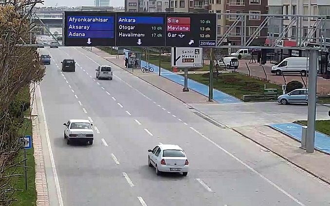
Electronic guidance and information screens that are implemented at the 55 point in the city center by the Konya Metropolitan Municipality make citizens' lives easier.
The electronic guidance and information screens implemented by the Konya Metropolitan Municipality in the city center informs the average arrival times between two points, road condition, information, car parking guidance, accident and transportation conditions.
In order for the system to be better understood by the users, the statement made by the Department of Transportation Planning and Rail Systems is as follows:
Ları Electronic routing and information screens; Intercity and local directions are designed to increase traffic safety and comfort by providing instant information to the drivers in terms of traffic, road accidents, traffic accidents and road conditions affecting the flow and safety of traffic by showing the instant travel times to the shooting points on the route.
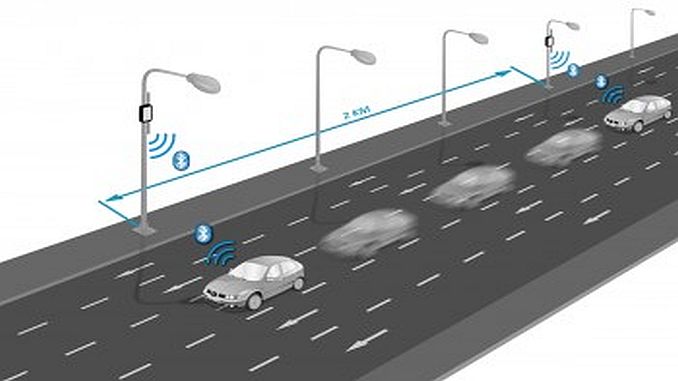
The system consists of 88 pcs average travel time detection sensor, 55 pcs electronic led display, 55 pc camera and their components and central traffic management software.
How to Determine the Travel Time?
The bluetooth-based sensors we use detect and match bluetooth-enabled devices in vehicles that pass at least 2. Average travel time is calculated on the vehicles detected. In other words, the average travel time of the vehicles traveling on the route you are on is shown on the screens.

The travel times of the routes created using the data from the sensors are calculated and the times are colored according to the density (green-flowing, yellow-dense, red-very dense).

How to Create a Route?
In the route between the start and the destination, the time between the consecutive sensors will be combined to see how long the destination will be reached.

What are the Use Scenarios?
1- Routing and travel time

2- Parking guidance and instantaneous capacity display
With this system, direct and closed car parks over a certain capacity in the center are guided and the number of empty platforms is momentarily displayed.

3- Traffic Events and Situations


Konya; The city center, the ring roads, the lower-overpasses, the bridged and the signalized intersections are monitored by hundreds of cameras by the Konya Metropolitan Municipality Traffic Control Center and are monitored live with the data flow from the sensors. The planned or instantaneous traffic events are shown to the drivers via the DMS screens, thus increasing the traffic comfort and safety of navigation.


Be the first to comment