Ankaray Map: ANKARAY vehicles in operation maximum 80 km / h and the average 35 km / h cruising speeds. The traction system of the vehicles is designed to supply the power network with the energy generated during the electrical braking.
ANKARAY System, 1992 and 1995 by the Consortium of ANKARAY, was made by turnkey system. Compared with similar systems in the world, this is a short construction process.
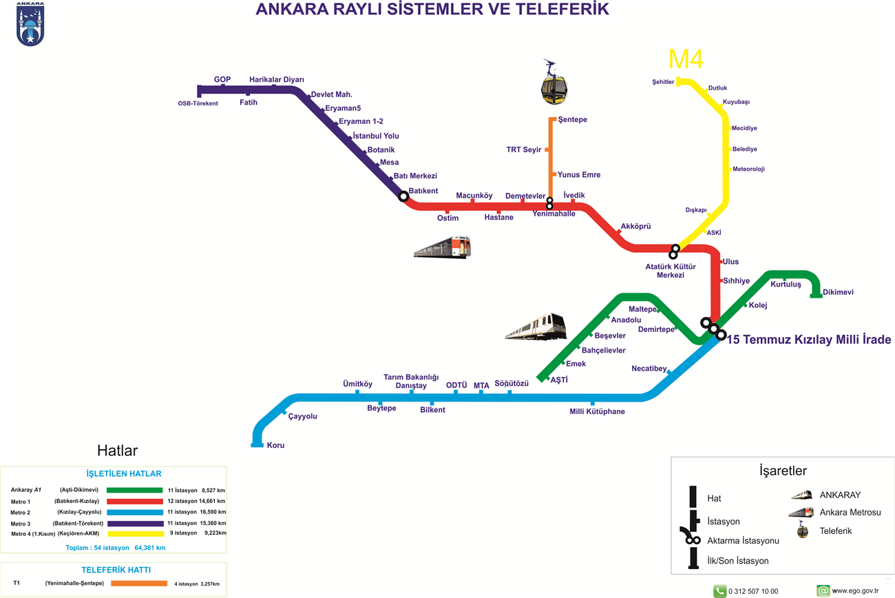
Ankaray Stations
Ankaray Metro Line, Ankaray Stations - A1 metro line serves between Dikimevi- AŞTI bus station and stops are:
- Dressmaker
- Kurtulus
- Rail
- Red Crescent
- Demirtepe
- Malta
- Tandogan
- Besevler
- Bahçelievler
- Emek
- Ashti

Ankaray Opening Hours
06: 00 - 24: 00 between the hours served in the Ankara metro of Ankaray is connected with the Kızılay station.
Ankaray Cost and Capacity
In 1992 began its construction and 550 million German marksAnkaray, which started to operate in the summer of 1996. The 8,5-km rail system with 11 station carries 35-45 million people annually.
Be the first to comment